-
It is an aerial surveillance solution that combines three core functions.
State-of-the-art technology and its versatility make our products unique and effective.
Each of our products can benefit from these three key features.-
GNSS-FREE positioning.
Works in environments where GPS is denied -
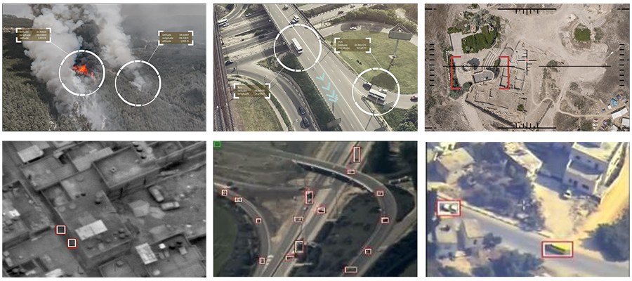
Extract coordinates from video image.
Find accurate map coordinates of targets from video -
Detection, identification and tracking
Identify and track stationary/moving objects on video
-
-
Locator
- Video-based GNSS pre-positioning software for Airborne platforms
- Real-time correction of GPS and INS data using industry-leading VIDEO-ANCHORING software
- Supports continued flight of day/night aerial platforms even when GPS is spoofed or blocked
- Does not use RF communication, does not require special hardware and is fully protected from external attacks
- Can be installed on a Linux or Windows SOM and easily integrates with the platform's controller
- Works throughout the flight, effectively replacing jittery GPS when needed.
- Output data is used for INS drift recalibration
-
FLIGHT
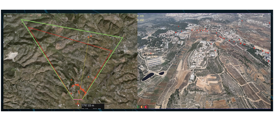
- Real-time extraction of accurate Real World coordinates of DRONE video screen pixels.
- Provision of accurate data to civilian engineering, military intelligence asset acquisition systems, perimeter security systems, etc.
- Used internationally for over 15 years by a group of experts for the most sophisticated aerial geolocation tasks.
- Geo-Positioning (Geo-Reference) software to extract real-world coordinates from real-time and offline video day and night.
- Automatically detect, track, identify specific objects (fixed and moving) from DRONE video and display their location on a map.
- Areas of interest can be created/set and integrated seamlessly with existing C4I control systems.
- Installed in command and control systems.
-
Aerial detection and identification
As a result of convergence of video motion detection and deep learning suitable for aerial surveillance, it is possible to detect and identify very small objects, and the identified objects are used as highly reliable information assets along with the object's map coordinates.